Chesterfield unveils draft land-use plan for Route 10 corridor north of courthouse area

Chesterfield officials are proposing a new land-use plan for a 3.5-mile segment of Iron Bridge Road, north of the county’s courthouse area. (BizSense file)
Chesterfield officials are working on land-use guidelines for a 3.5-mile stretch of Iron Bridge Road between the county airport and Chippenham Parkway.
The proposed Northern Route 10 Corridor Plan, a draft of which was released last week, would provide recommendations for the development of 858 acres that include the Austin Woods and Meridian Watermark residential developments, the Food Lion-anchored Irongate Shopping Center and surrounding areas.
Chesterfield officials zeroed in on the corridor for a dedicated special area plan because it has seen less development compared with the county’s other major roads, but is also close to growth in the courthouse area and recreational amenities.
“It’s relatively undeveloped compared to Hull Street Road or Midlothian Turnpike or Route 1,” Senior Planner Brett Meadows said. “And there’s some large vacant parcels and some parcels that are still agricultural in zoning name, but they’re in between Powhite and Chippenham, so that’s really where a lot of the growth is going. This is an area that has potential, and we’re just trying to get ahead of the curve.”

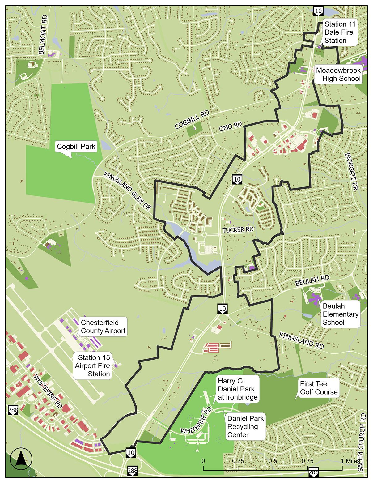
The 858-acre area that would be subject to the proposed land-use plan is outlined in black. (Courtesy Chesterfield County)
The draft plan would guide future rezonings and land-use decisions. It features recommendations for design standards, infrastructure, pedestrian access and other topics. If adopted, the plan wouldn’t change the zoning of parcels in the area or tee up development projects. County officials said the draft was informed by public feedback collected in the fall through a community meeting and survey.
The draft plan envisions a wider range of development than the current emphasis on auto-centric development in the corridor. It recommends new pedestrian and bicycle infrastructure intended to make nearby recreational amenities like the Harry G. Daniel Park, which borders the plan area to the south, and the future Cogbill Park, which is outside the plan’s boundary but connected to it by Kingsland Glen Drive, more accessible.
The plan features two “strategic development nodes,” which are considered anchor areas of the overall corridor and are envisioned as centers of development geared toward area residents and sports tourists who come to tournaments at the Diamonds at Iron Bridge softball facility at Daniel Park.
“The overall goal for this land-use plan is to support higher density, mixed-use nodes along the corridor to provide residents and visitors with greater access to businesses and amenities,” the draft plan states.

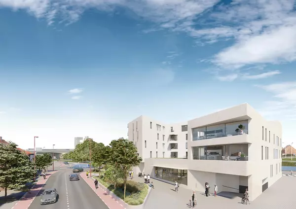
The development node recommended in the draft Route 10 corridor land-use plan for the Watermark shopping center suggests mixed-use development to create more amenities for area residents. (Courtesy Chesterfield County)
One of the plan’s development nodes is located at Iron Bridge and Kingsland Glen Drive and recommends mixed-use infill development and a more walkable design at Watermark Town Center, which has a vacant Walmart Marketplace.
The other development node would be between the county airport and Daniel Park. It would be geared toward visitors from the airport or people coming for youth tournaments and recreational facilities and feature hotels and restaurants and more walkable infrastructure.

The development node recommended near the Chesterfield airport and Daniel Park would cater to visitors coming from the airport or going to nearby recreational facilities. (Courtesy Chesterfield County)
While the corridor already has some pedestrian and bike infrastructure, the proposed plan recommends further expansion of those facilities. VCU graduate student Dagny Oakley, who is working with Chesterfield as a Wilder Graduate Scholars Fellow, said residents told the county they felt a lack of pedestrian infrastructure, which the plan recommends be addressed bit by bit as developers come forward with proposals.
“One thing we heard about was the lack of pedestrian infrastructure that exists right now in the corridor. There is that bike lane on Route 10, but it is a little treacherous,” Oakley said. “What we’re looking to recommend is a combination of both shared-use paths and sidewalks.”

The draft land-use plan includes new pedestrian and bike improvements to join existing facilities. (Courtesy Chesterfield County)
The plan would seek to retain some of the corridor’s existing appearance with recommendations for 75-foot buffers between Iron Bridge and future development for vegetated sites as well as cleared ones. The plan notes that the corridor has dense tree growth and vegetation, and that the landscape should be preserved as the area is developed.
The plan’s area consists of 840 parcels held by 540 property owners, and the plan states that 40% of the area is vacant.
The plan identified several challenges to the enactment of its recommendations. The plan states that 67% of the area is zoned for auto-centric uses, like self-storage and gas stations. That zoning poses a challenge to recommendations to create more walkability and a “cohesive feel” in the corridor.
Other challenges include limited wastewater access in the corridor, the presence of streams and wetlands that would restrict development and the potential for the airport, with its regulatory needs and noise, to hinder development.
The proposed Northern Route 10 Corridor Plan’s area is to the south of the Ridgedale Special Focus Area, which the Board of Supervisors adopted in late 2023. The land-use plans are incorporated into Chesterfield’s comprehensive plan, a long-range and countywide growth and development planning document.
The Northern Route 10 Corridor Plan is tentatively scheduled to be considered by the Planning Commission in June, with a vote by the Board of Supervisors later this summer.
A community meeting to discuss the plan will be held from 4:30-6:30 p.m. May 6 at the Beulah Recreation Center at 6901 Hopkins Road. The draft plan can be viewed here.
The post Chesterfield unveils draft land-use plan for Route 10 corridor north of courthouse area appeared first on Richmond BizSense.
Recent Posts
GET MORE INFORMATION

Agent | License ID: 0225209440


