Latest Mayo Bridge redesign shows two car lanes, plus bikes lanes, sidewalks and shared-use path
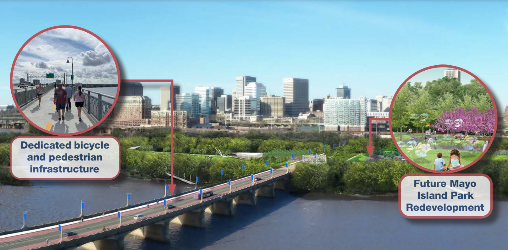
A rendering of the proposed future Mayo Bridge and Mayo Island park. (Images courtesy city documents)
The design of the planned replacement of the Mayo Bridge is starting to take shape.
Last month the City of Richmond, according to a federal infrastructure grant application, showed that the next incarnation of the bridge would include only two lanes of car traffic, down from the existing four lanes on the current bridge.
The rest of the planned revamp of the 66-foot bridge would include two protected bike lanes, a 6-foot sidewalk on the west and east side, and a 14-foot shared-use path that could act as a connector for the Virginia Capital Trail and under-construction Fall Line Trail.
The city proposed the new design in an application for a federal Better Utilizing Investments to Leverage Development (BUILD) grant, in which it’s applying for $25 million to help finance the nearly $200 million project.
Plans to replace the Mayo Bridge date back to 2022. It was initially thought the 112-year-old bridge’s surface (called the superstructure) needed to be replaced, but last spring a VDOT analysis found that its piers (the substructure) also needed to be replaced. That means the replacement bridge would have to be built entirely anew.
The discovery of substructure’s deficiencies more than doubled the project’s estimated cost from $90 million to $195 million. It also opened up more design possibilities for the new bridge, and last spring the city and the Virginia Department of Transportation began gathering ideas from the community.
Last fall an initial set of proposed designs by VDOT and the city’s Department of Public Works favored retaining four lanes of car traffic, but after speaking with many local stakeholders, newly installed Mayor Danny Avula directed the city to submit the grant application that included the two-travel-lane design option. Those stakeholders included the associations which represent the two neighborhoods that are linked by the bridge, the Manchester Alliance and Shockoe Partnership,
“Community members overwhelmingly wanted to prioritize sidewalks, bike lanes, and a shared-use path within the parameters of the flood wall opening and current neighborhood traffic flow,” Avula said in an email.
“The two-lane design meets my goals for a safer, human-scale bridge that builds towards a future with more walking, biking, and access to the proposed park on Mayo Island.”
Bike Walk RVA, the multimodal transit advocacy arm of local nonprofit Sportsbackers, worked with the city, Manchester Alliance and Shockoe Partnership on shaping the new bridge. Bike Walk RVA Director Brantley Tyndall said they’re thrilled that the new proposed bridge would improve bike and pedestrian access.
“The (Avula) administration’s decision to design a bike/ped-oriented bridge tracks closely with the clear and longstanding community preference expressed in plans and surveys over the past few years,” Tyndall said.
“The Mayo Bridge will be an important connector between the forthcoming Fall Line and the Virginia Capital Trail through the downtown feel of Manchester. A shared use path and wide bike lanes will drastically improve the safety and comfort of this essential crossing of the James River,” Tyndall added.
Approximately $88 million of the project’s $195 million cost is accounted for, and the remaining $82 million would come through “state, local, and regional funding sources provided by the City of Richmond, the Central Virginia Transportation Authority (CVTA), and/or VDOT,” per the city’s application. The federal grants recipients are expected to be announced this summer, with funds coming available in the fall.
The project’s construction timeline is unclear.
In the meantime, VDOT will continue conducting an environmental study on the existing bridge, and the future bridge’s design will continue to be finalized.
The existing bridge remains open, but will become unusable to the public by 2035 due to an alkali-silica reaction in its concrete that “significantly increases the risks of structural failure,” per the city’s grant application.
The current bridge was initially built in 1913 and replaced an original Mayo Bridge that had opened in 1788. It’s named for the Mayo family, which laid out the city’s street grid.
The Mayo Bridge also bisects a planned future city park on Mayo Island. The city bought the majority of the island last year for $15 million, though one small piece of it remains privately owned.
The post Latest Mayo Bridge redesign shows two car lanes, plus bikes lanes, sidewalks and shared-use path appeared first on Richmond BizSense.
Recent Posts
GET MORE INFORMATION

Agent | License ID: 0225209440


